Arthur River to Sundown Point Walk
/
Introduction
Starting from the evocatively named ‘Edge of the World’, at the mouth of the Arthur River on Tasmania’s wild west coast, this beach walk takes you along a stretch of broad, white sand to a rocky point of great significance to Tasmania’s indigenous peoples. It’s an easy half day (4 – 5 hour) walk that gives a good feel for this dramatic, windswept coastline facing the Roaring Forties and the Southern Ocean.

arthur beach
Getting There
Arthur River is a small town in the far northwest of Tasmania that sits near the mouth of the Arthur River. Edge of the World lies a few kilometres south of the town. It is a popular spot for tourists to check out the rugged coast and often fierce ocean. The next landfall to the west is Argentinian Patagonia over 10,000 kms away.

On most days the winds from the Roaring Forties blow incessantly and is the cleanest air in the world.
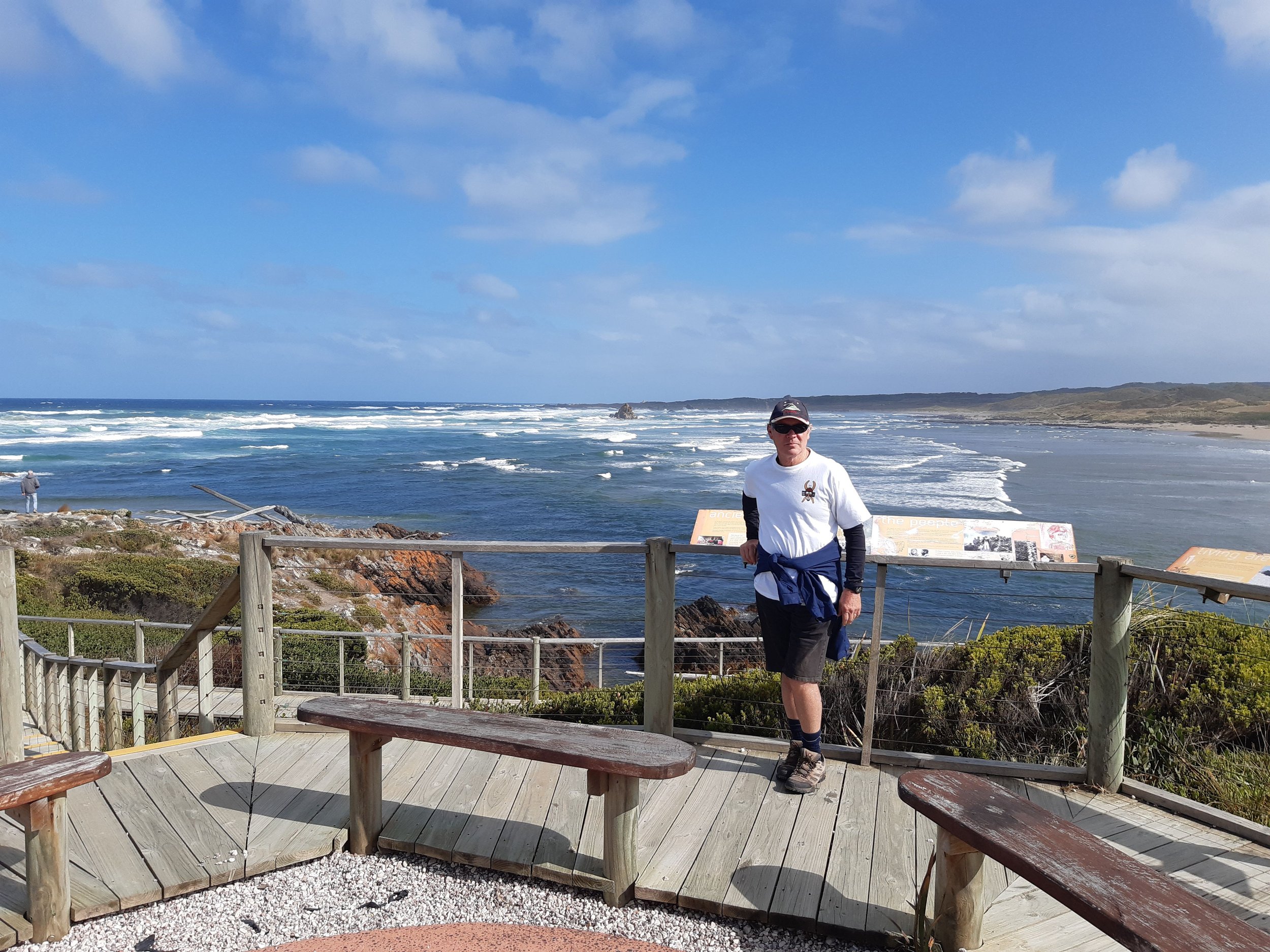
Before commencing the walk, we spent a bit of time checking out the view from the Edge of the World.

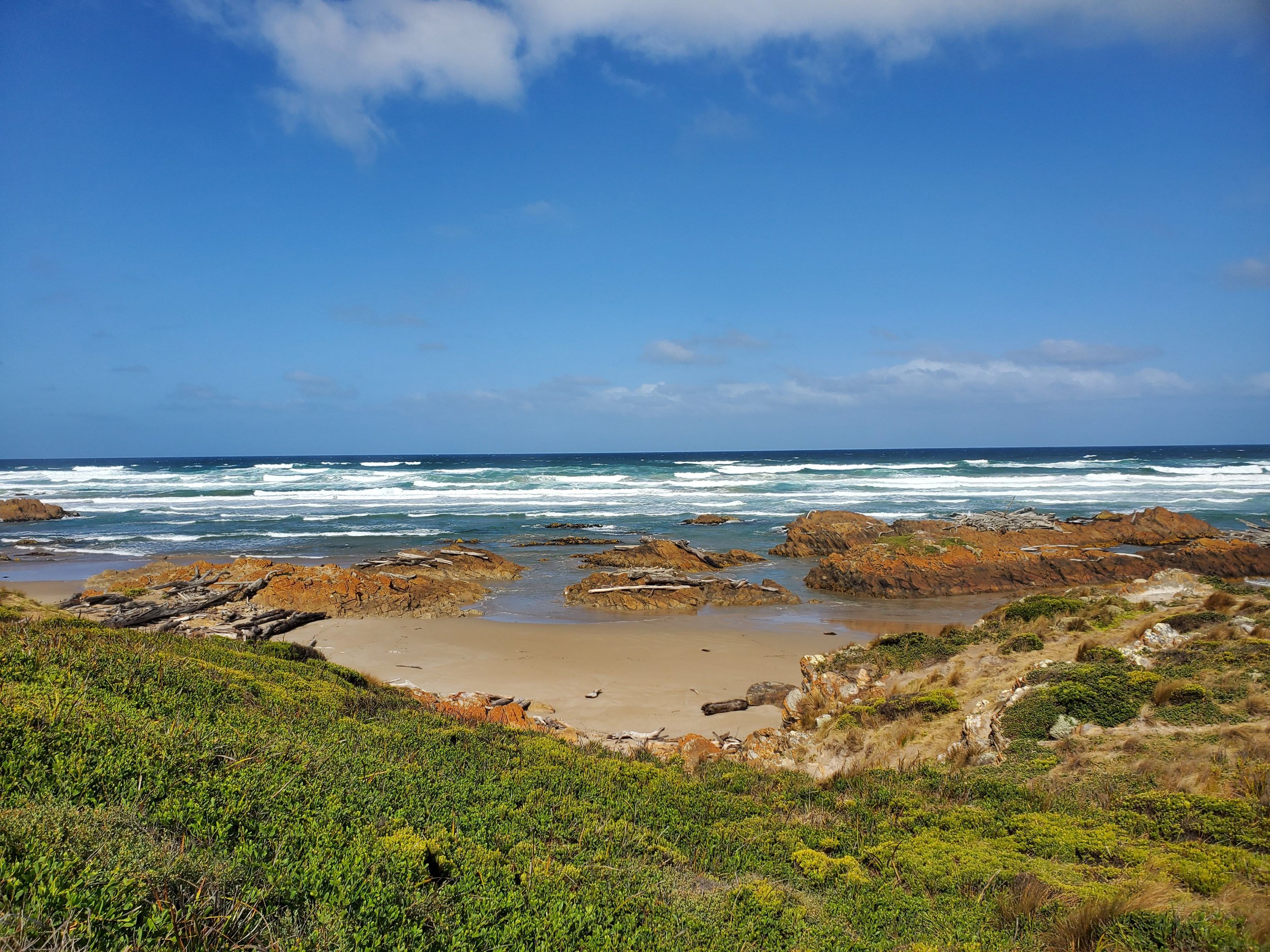
The Arthur River is the last, major undammed river in Tasmania, and much driftwood from the dense forests upriver ends up at the river mouth and along the adjoining beach, aided by frequent storms and big swells.

the mouth of the arthur river
Edge of the World has a well-constructed viewing deck.

And a raised path to the most westerly point complete with plaque.

The Walk
The track commences a couple of hundred metres back up the access road to the carpark. It is clearly signposted. Four wheel drive vehicles share this first part of the track. But it’s only for a few hundred metres until the beach is reached. Alternatively, you can follow the rocky shoreline south from Edge of the World.

The coastline is replete with staggering amounts of driftwood.

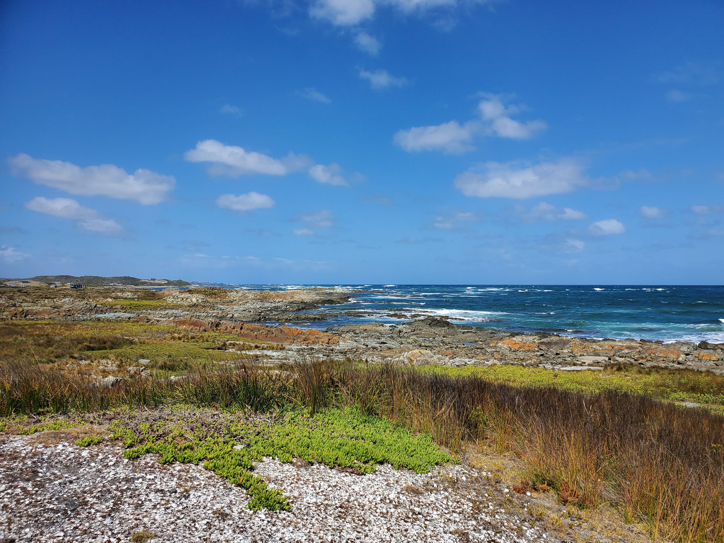
We headed down Arthur Beach for the 7 km or so walk to Sundown Point.

Interesting rock outcrops add to the wild landscape.

The beach is broad and covered in bull kelp in many places.

bull kelp
Sand dunes accompanied us as we continued south.

The walk was easy going.

With occasional rocky sections.

As we approached Sundown Point the track headed briefly inland.

More kelp.

After a couple of hours, we arrived at Sundown Point.

sundown point
The area was recently in the news (January 2022) due to the disappearance of some ancient aboriginal petroglyphs (stone carvings). Doubt remains as to whether this was caused by vandalism or natural erosion. Out of respect for this place, and its importance to the indigenous community, we chose not to walk around the point itself, or try to locate any of the remaining petroglyphs.

Instead, we climbed the hill behind the point to get an elevated view. To the south some shacks could be seen at Nelson Bay.
view south towards nelson bay
After a short lunch break, we returned by the same route.

Conclusion
This was an easy, pleasant walk that gave a good sense of the wild and dramatic landscape that is Tasmania’s west coast.

Postscript
The next day, with the winds picking up and the sea becoming even more angry, we drove north to West Point, which is just south of the town of Marrawah.

We wanted to check out the coastline and the surf here.

The wind was howling in, and the seas were boiling.

Powerful and impressive.

We also took the time to visit Greens Point Beach at Marrawah, one of Tassie’s most renowned big wave surfing spots.

green point beach
Ken