Cape Surville Walk (With a Little Help From an E-Bike)
/
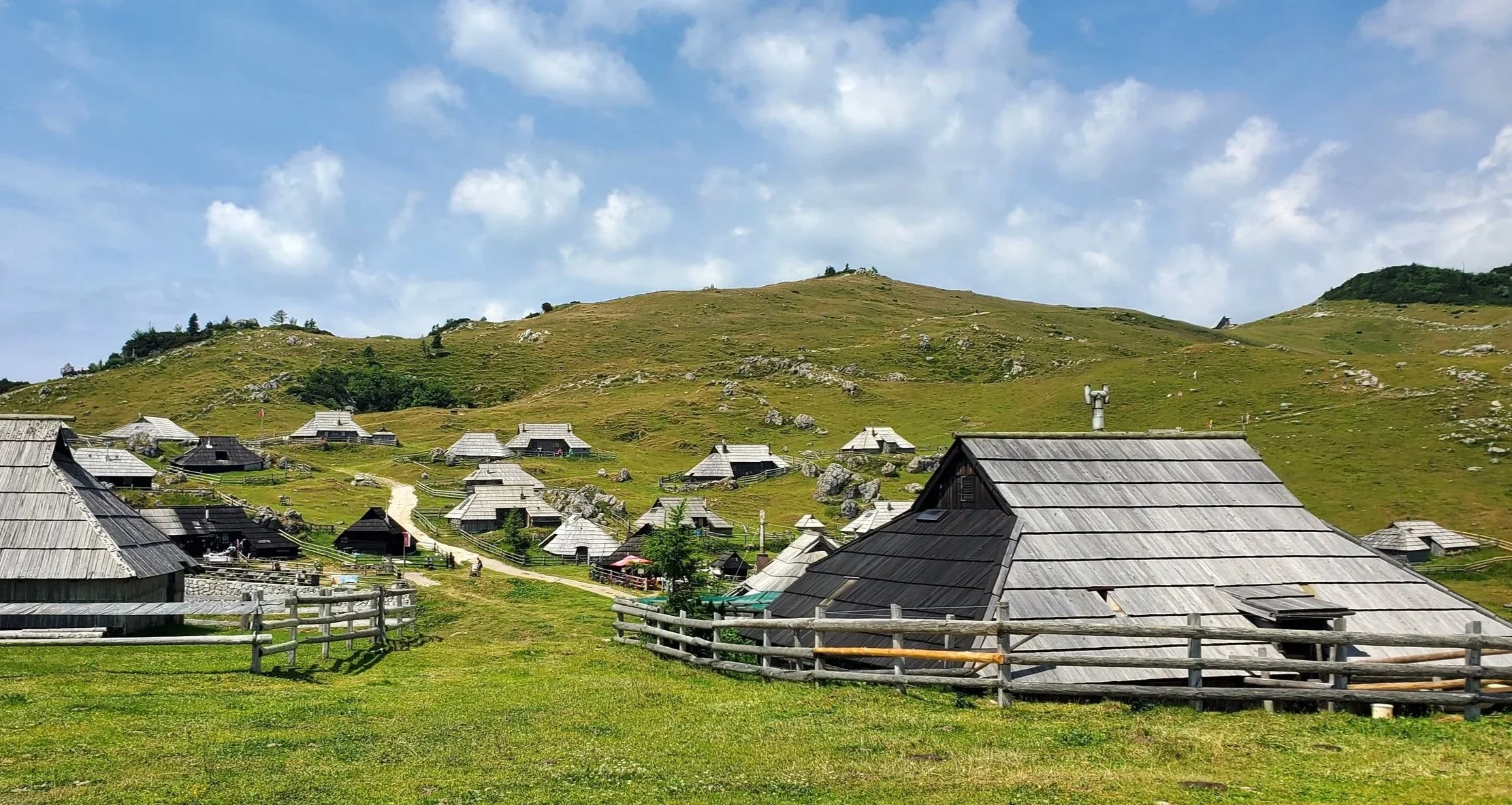
high yellow bluff as viewed from cape surville
Introduction
Cape Surville is a little visited, but spectacular location on the Forestier Peninsula, on Tasmania’s east coast. A return walk of just under 6 kms features some dramatic high sea cliffs. The access road in is rough in parts and requires a four-wheel drive vehicle. We didn’t have one, but solved this problem by cycling the most difficult section on e-mountain bikes (EMTBs). Here’s how we did it.
Getting to the Walk
Cape Surville sits within the Tasman National Park on the Forestier Peninsula, which is just north of its more famous neighbour, the Tasman Peninsula, where the World Heritage Port Arthur Convict site, the renowned Three Capes Walk, and Australia’s highest sea cliffs are all to be found.

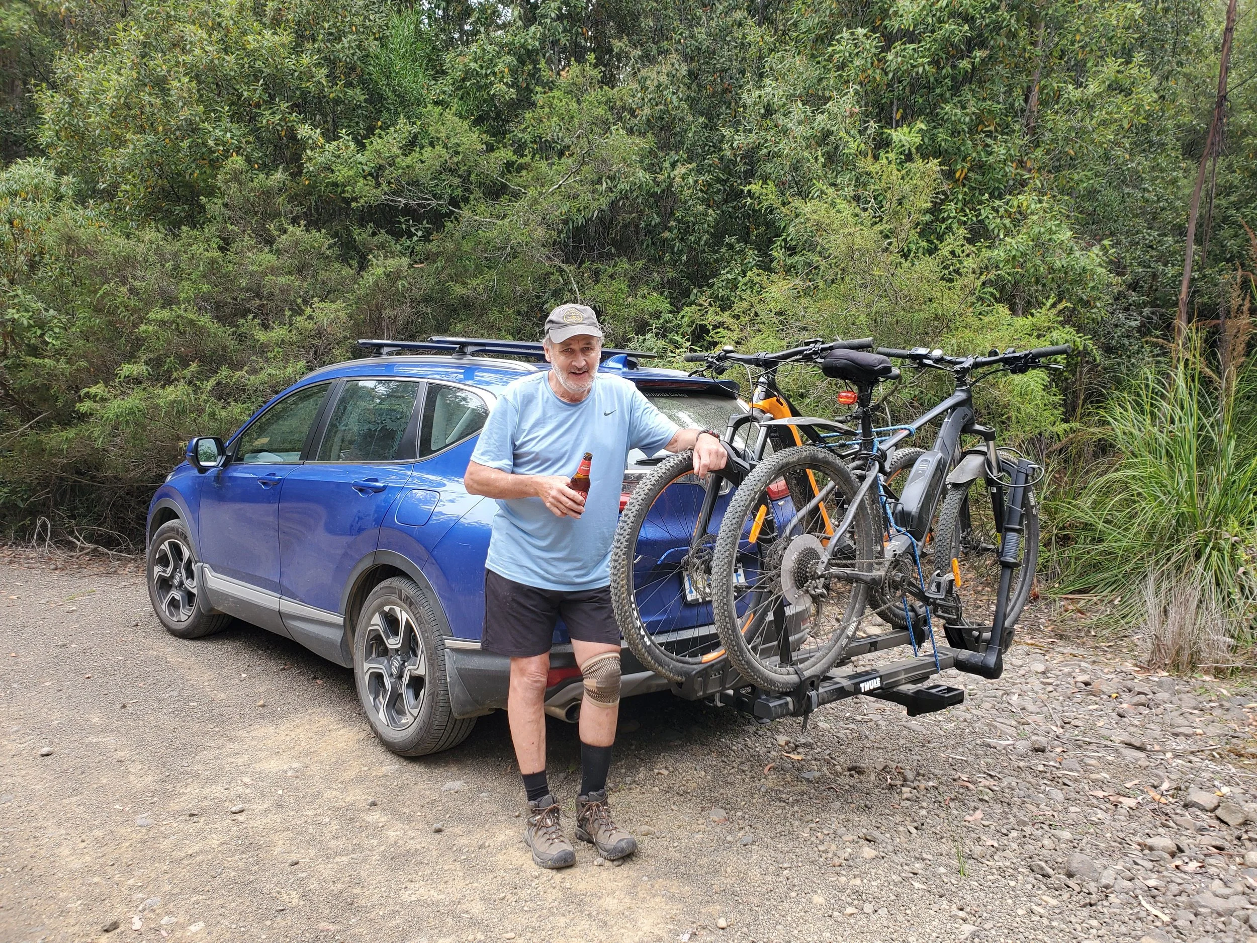
To reach the start of the walk turn off the Arthur Highway at Murdunna onto Hylands Road. It is then a 13 km drive to the entrance to the Tasman National Park and the beginning of the walk. Various guidebooks and blogs that we consulted (all some years old) simply advised to drive the full distance. However, in recent years the road has deteriorated significantly and nowadays a 4x4 is recommended. In our SUV we were able to drive comfortably to within 6 kms of the walk, but at this point we did not want to risk damaging the car, so we parked up.

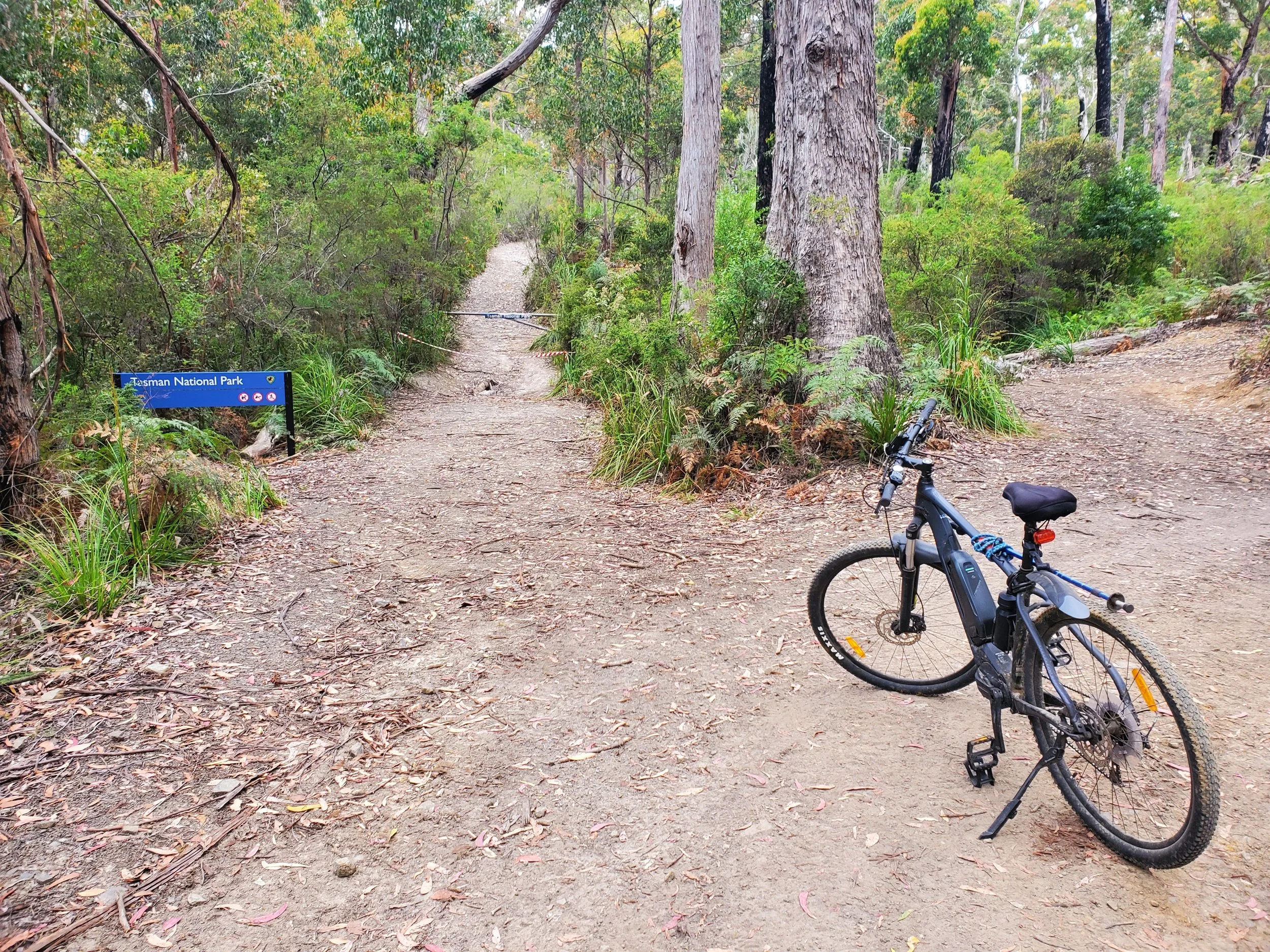
national parks notice on the road beside where we parked
With regular walking companion, Graeme, we unloaded our EMTBs and rode the remaining distance to the start of the track.

At one point we passed a turn off to our left to Yellow Bluff Creek Conservation Area. We’ll save that for another day.

The car park mentioned in notes is just inside the entrance to the national park, which has been blocked off to prevent vehicles entering.
At this point we hid our bikes in thick scrub.

From the now disused car park we got a good view Cape Surville, our destination.
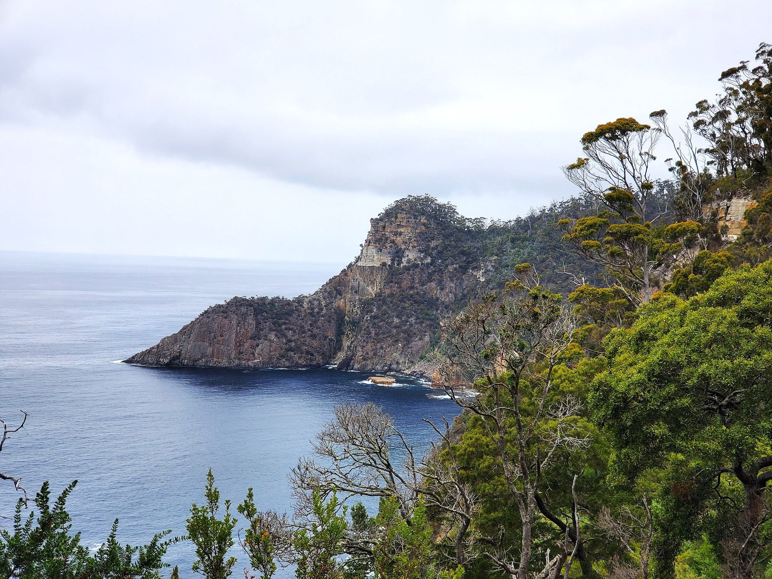
cape surville from the old car park. The track ends on the knobby high point.
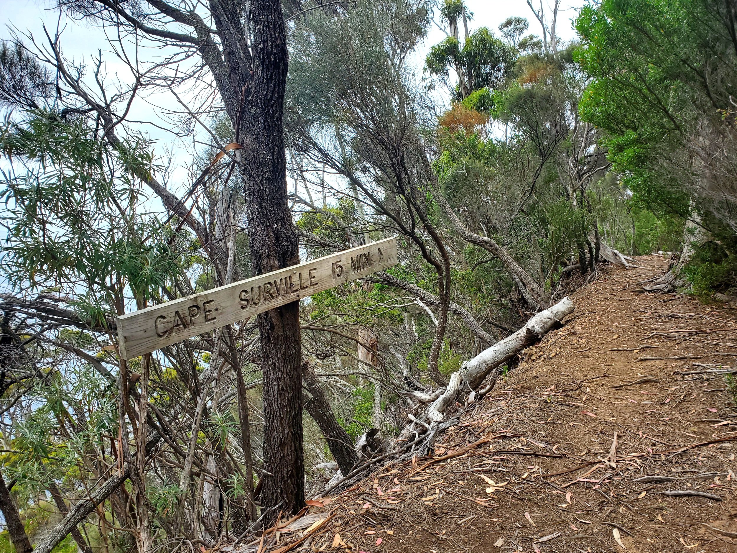
Clear signage points the way to the Cape.

The Walk
It starts in thick native forest.

There is a lot of up and down on this walk, so we were grateful that the track was dry, and that we’d brought walking sticks.

We crossed a creek with a little waterfall that plummeted 200 metres to the sea below.

the top of the little waterfall
Happily, the trail flattened out in parts.

Only to be followed by more steep sections.

We passed through some protected fern glades.

And across a stream.

An old sign pointed the way to our final stretch.
A side track led off to MacGregors Peak. Not today.

Some good views emerged of High Yellow Bluff to the north.

The track also then opened up with views to the south of Sisters Rocks and Deep Glen Bluff.

After just over an hour, we reached Cape Surville and were rewarded with unobscured views of High Yellow Bluff.

After a bit of a rest, we returned by the same route.
Conclusion
The signage at the start had said “Three Hours Return”. We did it in 2.5 hours, including the rest at the cape, and we weren’t going particularly quickly. While it was testing in parts due to some steep sections it’s worth it for the great views.

We were pleased that we’d used the EMTBs for the road in, saving us around 12kms of extra walking. But if you have a 4x4 you can drive to the beginning of the walk, no problem.
Overall, a worthwhile day walk to a part of Tassie that doesn’t get a lot of visitors.
Ken