The Growling Swallet
/
Introduction
What the hell is a swallet? And if it’s growling, should you avoid it? Sounds nasty. In fact, a “swallet’ is defined as an “underground stream”, also “an opening through which a stream disappears underground” (Webster’s Dictionary).

Tucked away in a corner of Mt Field National Park in Southern Tasmania is Growling Swallet. This part of Tassie contains the Florentine-Junee karst system, making it an area full of limestone caves and underground streams.

The dramatically named Growling Swallet is a place where the Junee River disappears underground through a large cave.

junee river at growling swallet (looking upstream)
It is said that when the river is running hard it positively growls. I’d never heard of this place until recently when a friend, Graeme, mentioned it. He also had only just learned about it. We decided to check it out. Here’s what we found.
Getting There
The closest town is Maydena near Mt Field National Park. We headed west from Maydena on the B61 for a few kilometres before turning right onto the Florentine Road, a busy, unsealed road used a lot for forestry operations. The turn off onto the Florentine Rd isn’t signposted as such, it’s the same turn off as the brown signed Styx Trees Drive. The Florentine Rd goes straight ahead after a few hundred metres and the Styx road hooks right. We drove on the road for around 20 minutes until we reached the gated road F8 East on our right.
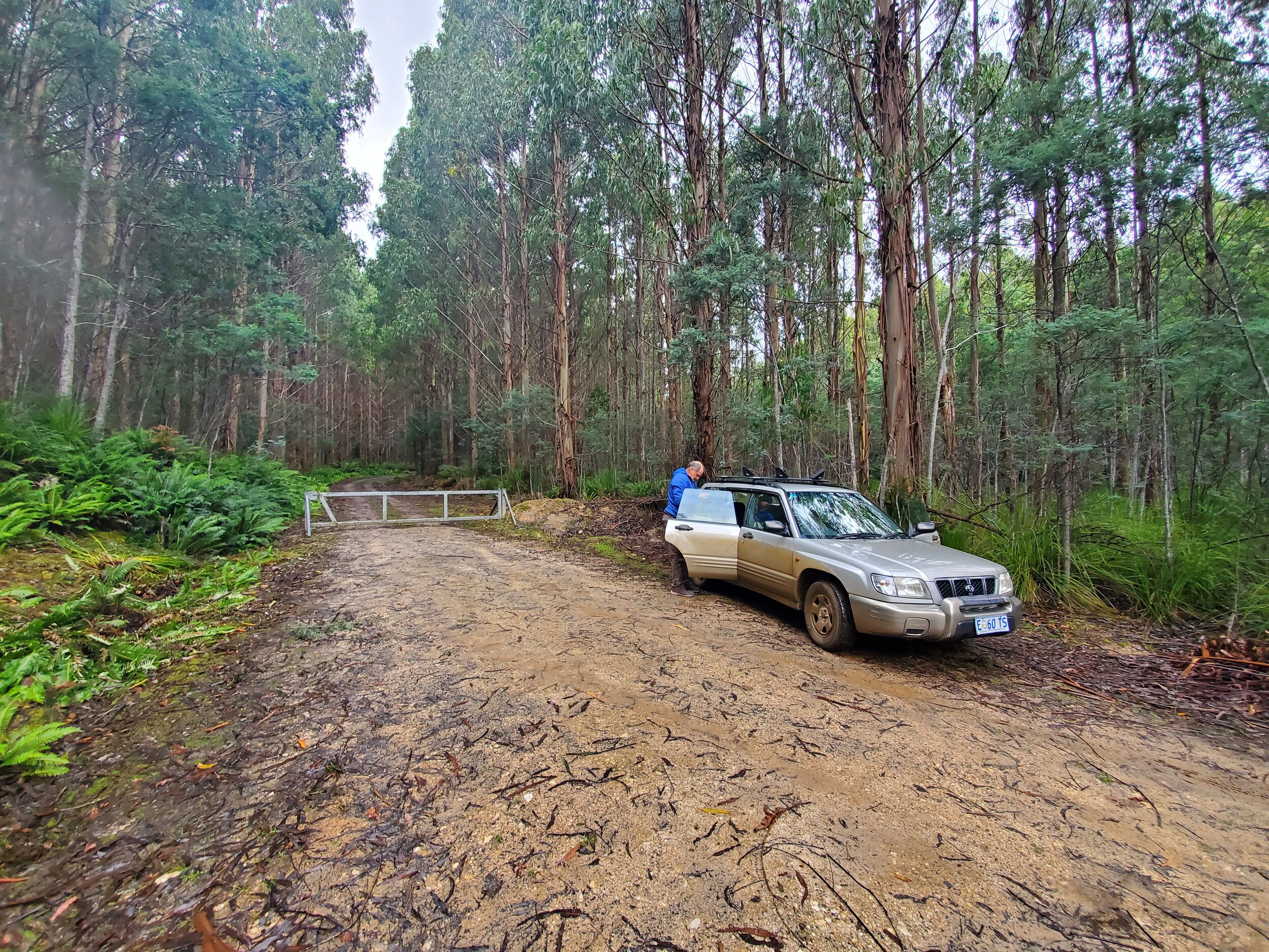
Apparently, a key to the gate can be borrowed from the Mt Field Visitors Centre ($300 deposit), and you can then drive the 1.7 or so kilometres to the start of the track. We decided to avoid the mucking about with keys thing by taking mountain bikes for that section. Equally, we could have just walked it.

The bike choice worked well for us, and we soon found ourselves at the end of this short forestry road and the beginning of the Growling Swallet track.

the track starts just behind graeme, on the right of the photo
The Track
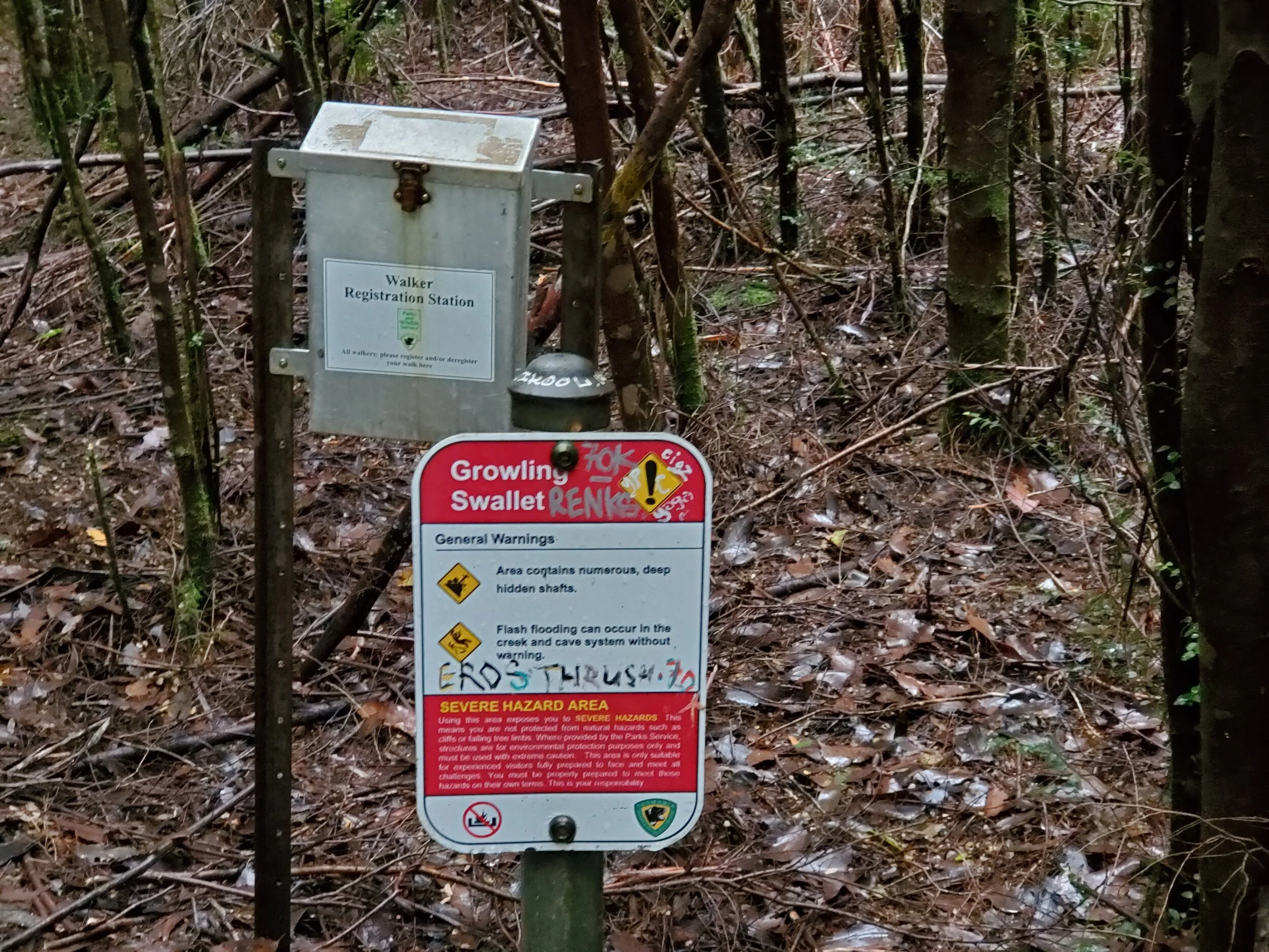
There is signage at the beginning of the track to reassure you that you’re in the right place.

The trail immediately takes you into thick rainforest.

Not far along another sign indicates that you are entering the National Park.

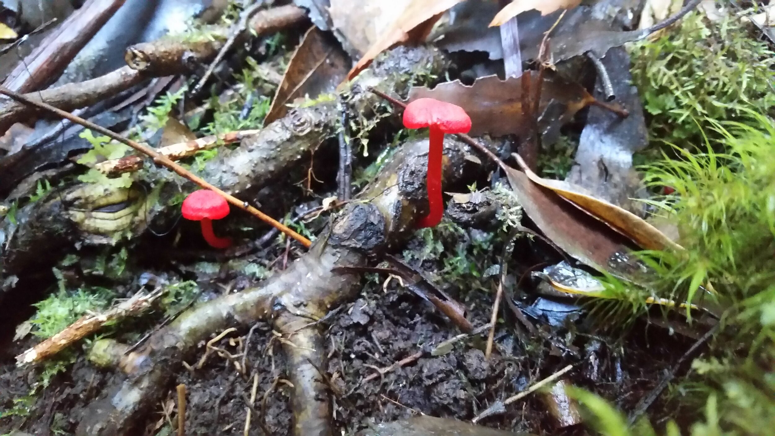
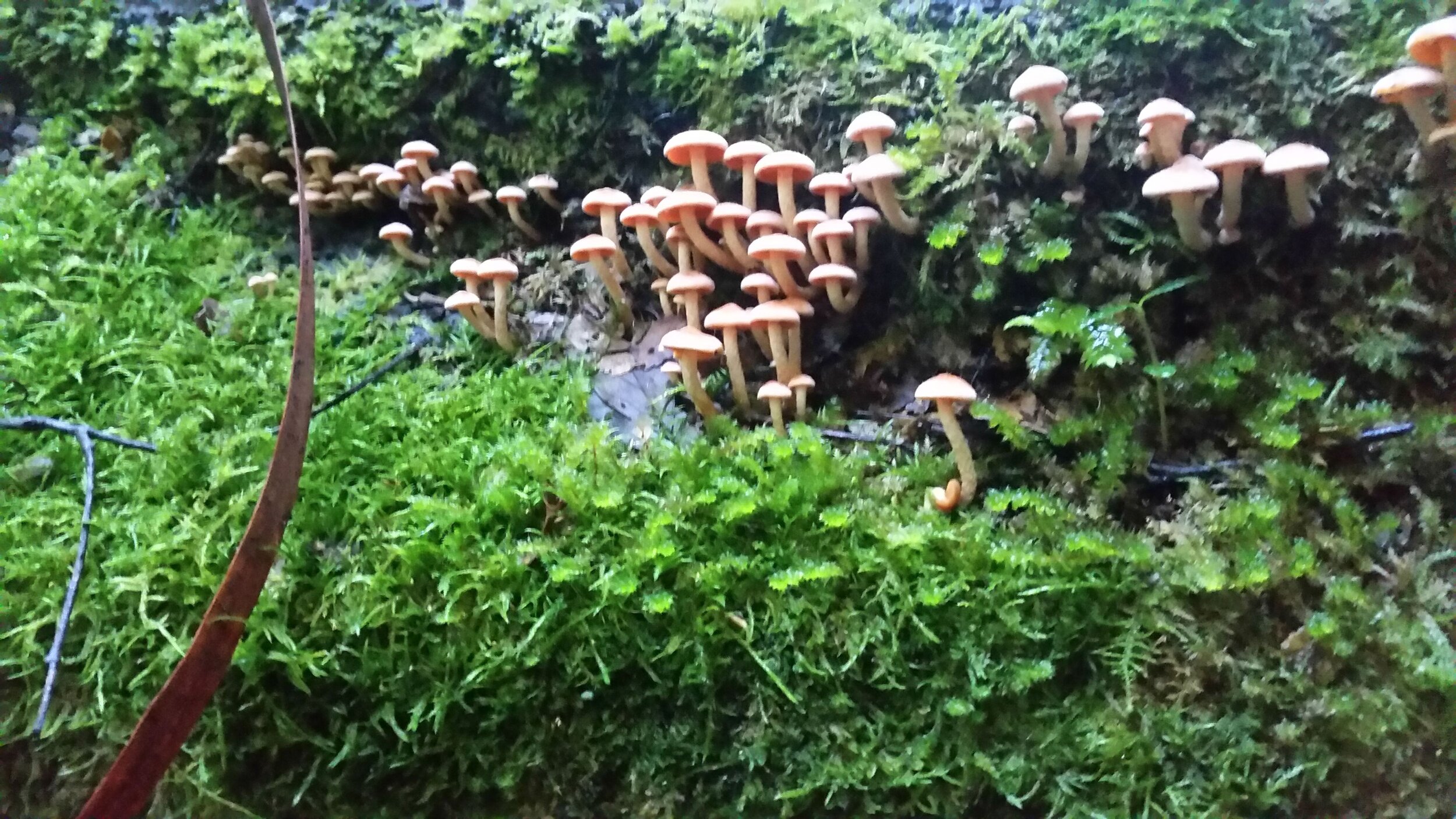
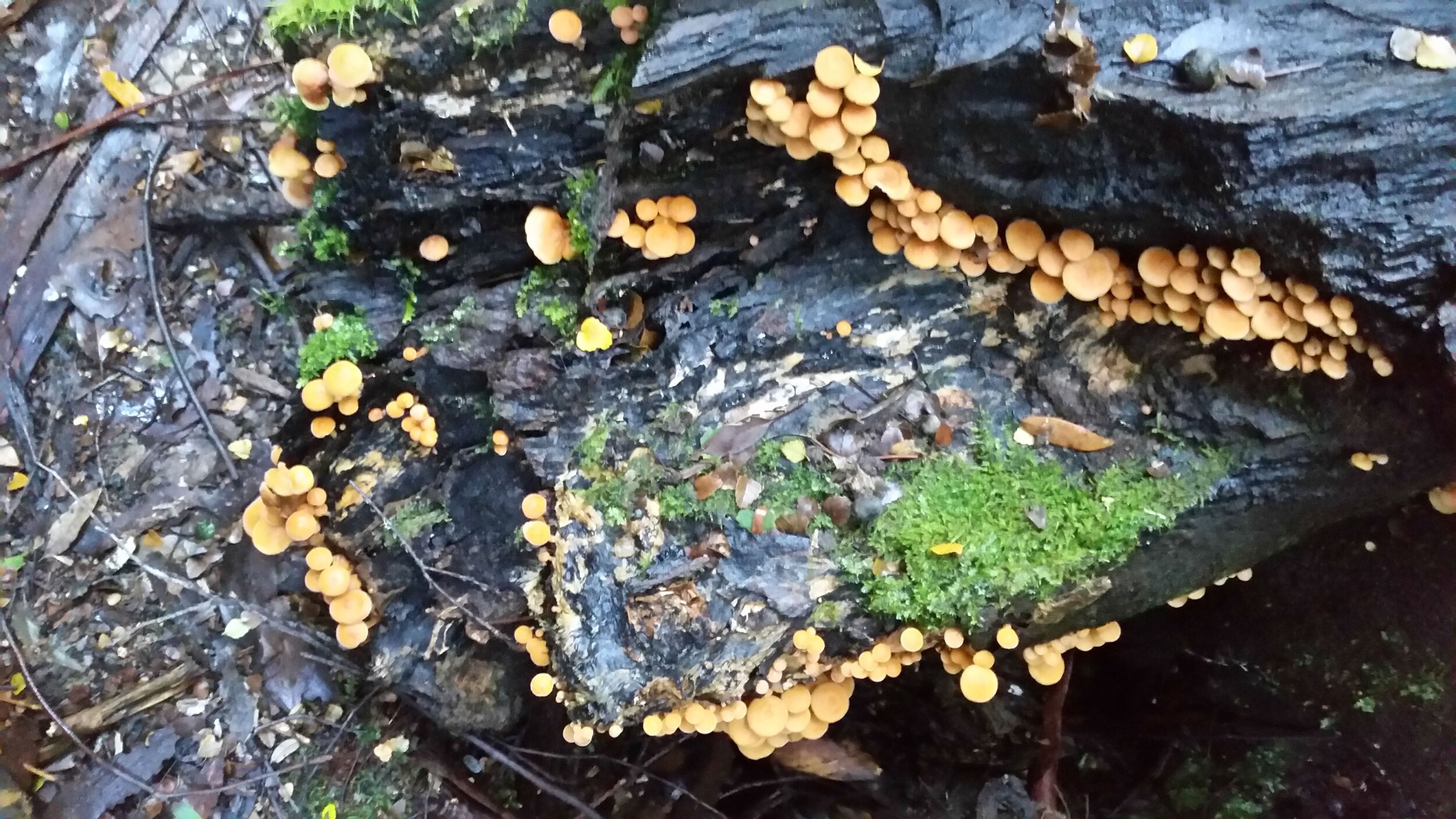
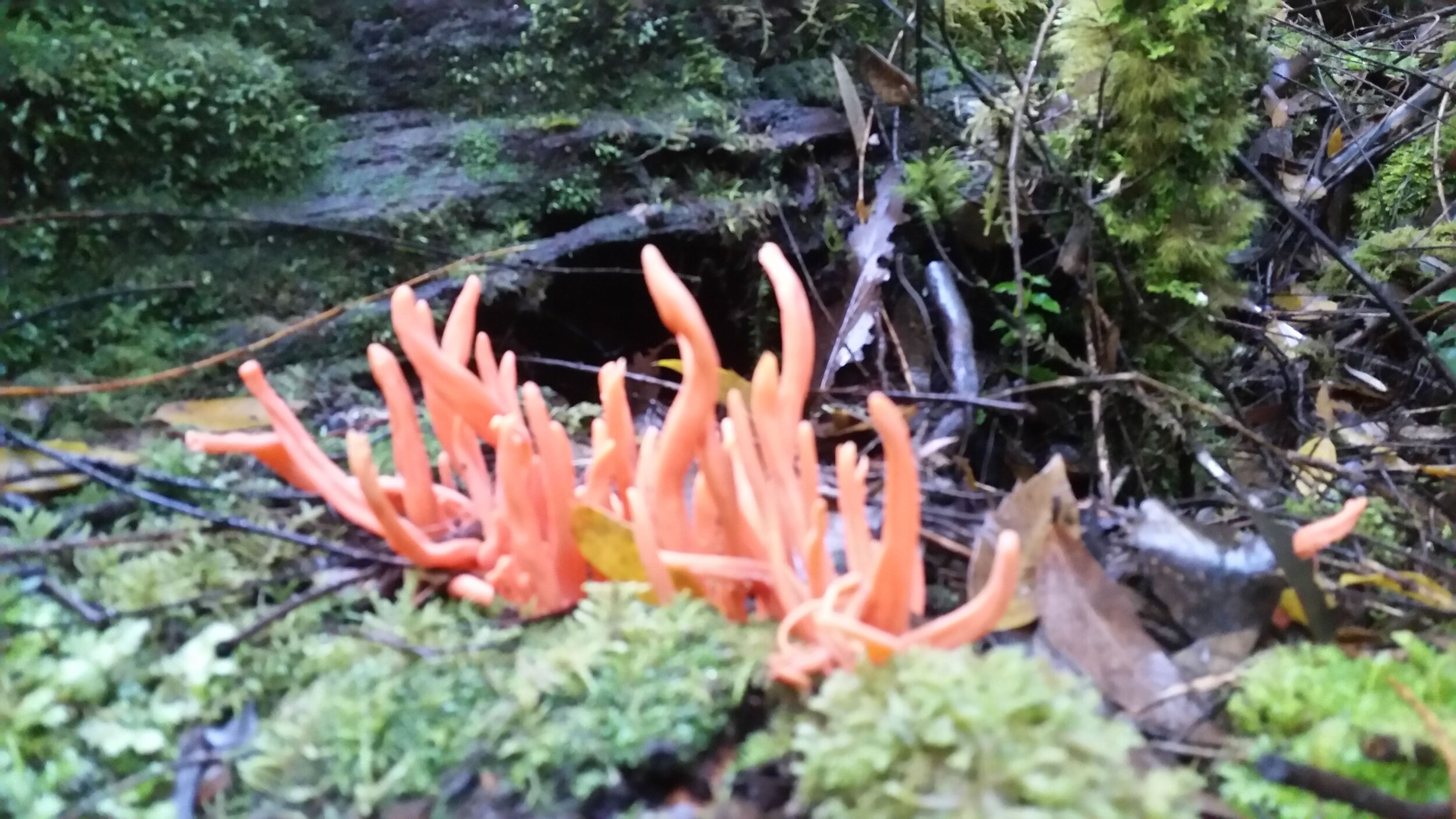
There were lots of amazing fungi on display.
The track is clear, and we had no trouble following it.

There are some huge, majestic trees to admire.


In parts it gets pretty boggy. We were pleased we’d chosen to wear waterproof hiking boots and to take walking sticks for balance.

After about 1.5kms we came to a short drop, with handy rope to help ease ourselves down.

This was the end of the track and we could view the Growling Swallet in all its glory.

There was a fair bit of water flowing in the river, which meant that it wasn’t feasible to safely get down into the cave.
Nevertheless, we were still able to get some great views.

We then returned via the same route.

junee river on the left, path back on the right
And bicycled back to the car.

The total distance from where we parked by the locked gate to the swallet and back was about 6kms.
Conclusion

We’d read that the Junee River emerges back above ground after some kilometres meandering underground at Junee Cave State Reserve, just out of Maydena. We decided that, to complete the experience, we’d go and have a look at it coming back into the daylight.

the junee river soon after it emerges from the junee cave
From Maydena township it’s a 4km drive to the reserve.

An easy 10 minute walk down a well-trodden path took us to a viewing deck at the mouth of the cave, where the Junee River emerges.

It was a fitting way to end our Growling Swallet adventure, an easy daytrip from Hobart.
Ken